![]()
ROOSEVELT FALLS |
|
|
RATING -
47.0
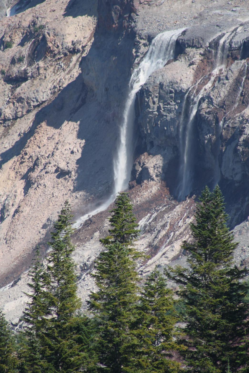
VR - 6.0 (Med) HR - 6.5 SR - 8/20 TYPE - Segmented HEIGHT - 200' WIDTH - 250' TYPE OF APPROACH - Roadside DIFFICULTY - Very Easy LOCATION - Glacier Creek Road GPS - N48 48.072 W121 51.224 ELEVATION - 4750' |
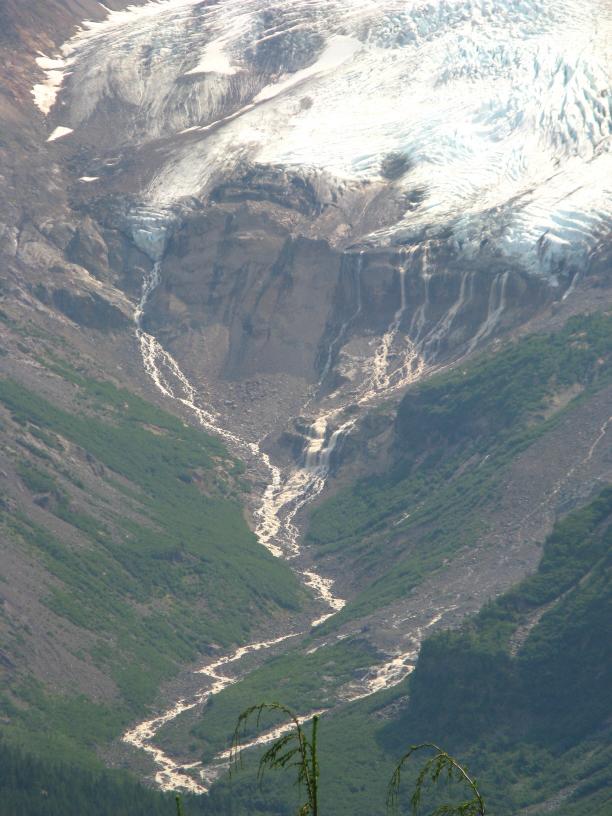 The Roosevelt Glacier ends and Glacier Creek begins.
Roosevelt Falls is the series of falls that dump off the toe of the glacier. While
the mountain views over-shadow this great waterfall, it still is impressive to see.
The volume and shape of the falls can vary dramatically depending on how
much ice is melting at any given time (see two pictures below taken only
about an hour apart). The Roosevelt Glacier ends and Glacier Creek begins.
Roosevelt Falls is the series of falls that dump off the toe of the glacier. While
the mountain views over-shadow this great waterfall, it still is impressive to see.
The volume and shape of the falls can vary dramatically depending on how
much ice is melting at any given time (see two pictures below taken only
about an hour apart). |
|
DIRECTIONS - Head
East on the Mt. Baker Highway to the town of Glacier. Just past the town turn right
onto Glacier Creek Road. The falls can be viewed from the Heliotrope Ridge
Trailhead. Closer views of the falls can be attained from the end of the trail near
Coleman Glacier. NEARBY WATERFALLS - Eldridge Falls, Heliotrope Falls, Hogsback Falls, Kulshan Falls, Rock Gnome Falls, Smith Creek Falls, Tennant Falls, Twin Falls |
|
ADDITIONAL PICTURE (CLICK TO ENLARGE)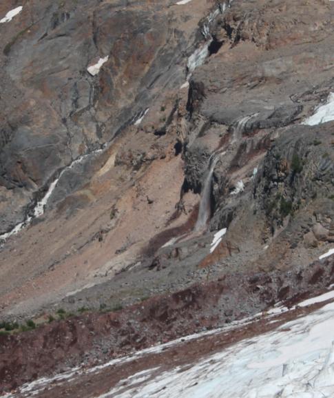

 |
|
HOME WHATCOM COUNTY LINKS BEST IN THE NW WATERFALLS FOR KIDS FLICKR FACEBOOK STORE |
|