|
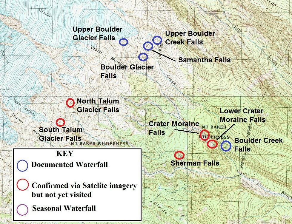
BOULDER CREEK AREA Boulder Creek is a large volume creek that is crossed on a massive, curving bridge while driving down the Baker Lake Road. The view of Mt. Baker rising over the creekbed is stunning. There are 10 waterfalls in the Boulder Creek drainage that I have located thus far. The vast majority of these require long, difficult, off-trail treks to visit. The only remotely easy-to-view waterfalls on Boulder Creek can be seen at the end of the Boulder Ridge Trail. From atop the glacial moraine, hikers can get a view of four named waterfalls along with several other unnamed ones. The massive dome of Mt. Baker looms high above the scene creating a fantastic overall scene. The hike to the ridge is around three miles each way. The first two miles are pretty easy and then the trail climbs very steeply for the last mile or so. Click on the red-named waterfalls to get more information about them. |
 |
WATERFALL | RATING |
|
Boulder Creek
Falls Boulder Glacier Falls Crater Moraine Falls Lower Crater Moraine Falls North Talum Glacier Falls Samantha Falls Sherman Falls South Talum Glacier Falls Upper Boulder Creek Falls Upper Boulder Glacier Falls |
64.0 52.0 43.0 61.0 21.0 |