![]()
UPPER BOULDER CREEK FALLS |
|
|
RATING -
60.0
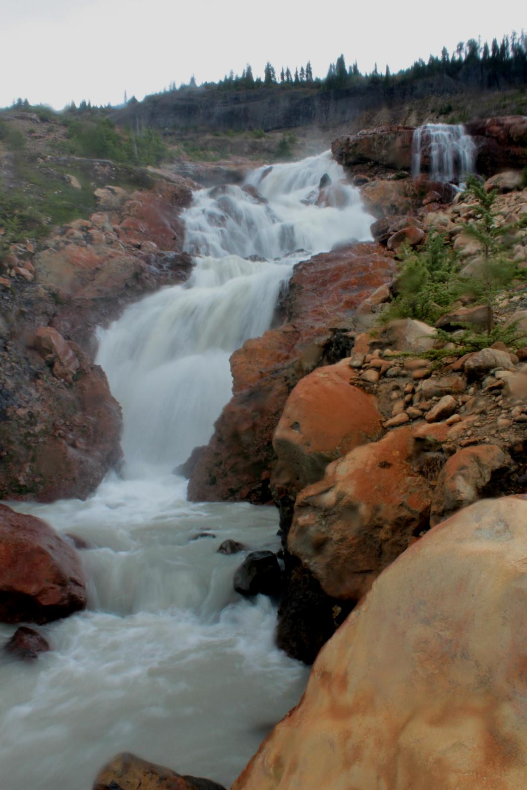
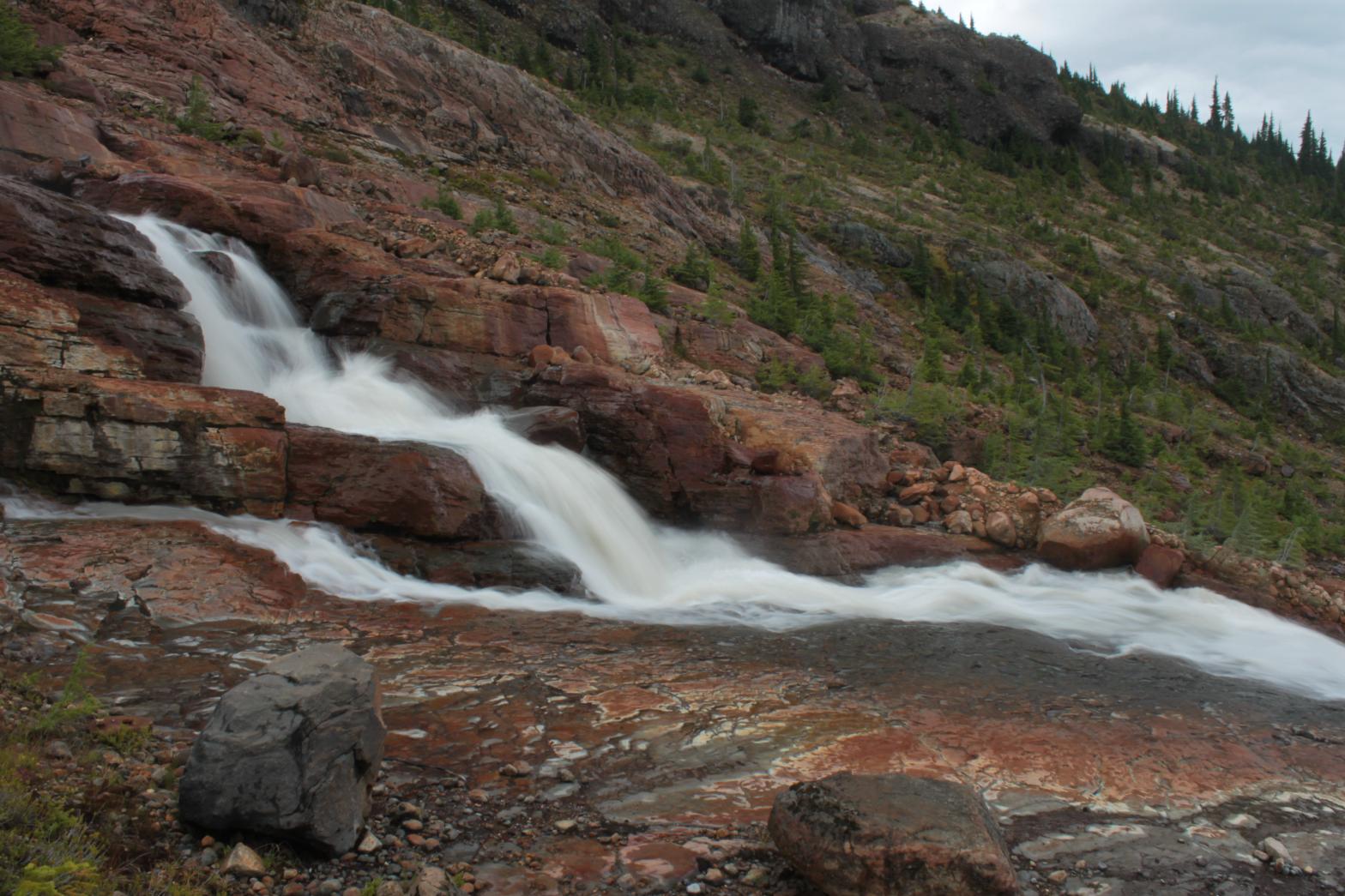
VR - 6.0 (Med) HR - 8.0 SR - 12/20 TYPE OF APPROACH - Trail DIFFICULTY - Difficult LOCATION - Baker Lake Road TYPE - Cascades HEIGHT - 429' WIDTH - 10' GPS - N48 45.451' W121 45.594' ELEVATION - 3934'
|
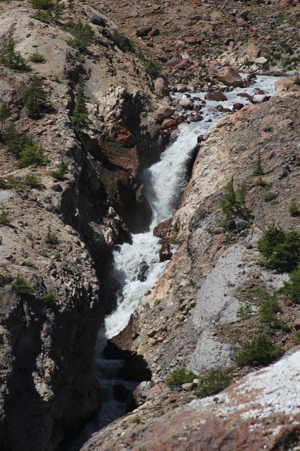
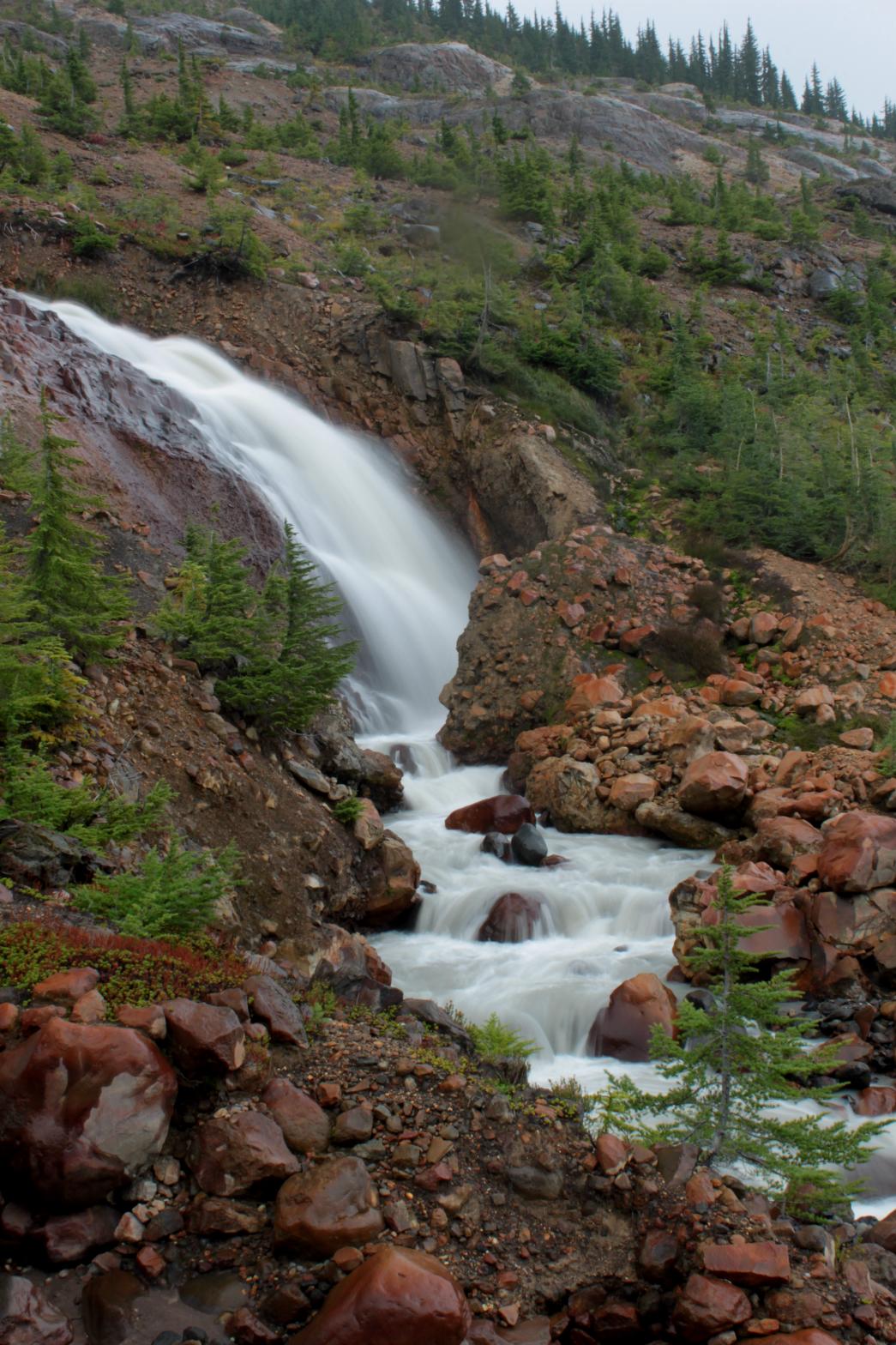
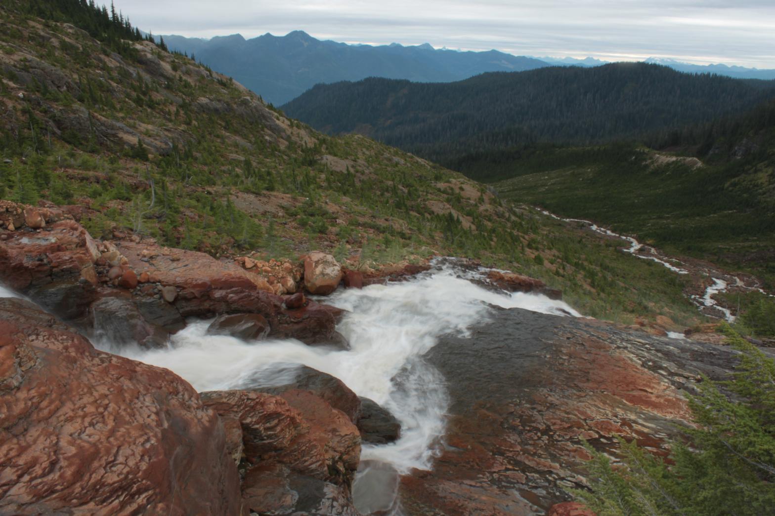
Upper Boulder Creek Falls is the best waterfall in the area and occurs on the main branch of Boulder Creek just downstream from the glacier. The waterfall begins with a 20' plunge into a small, narrow canyon. The creek cascades through this canyon for 163' in a series of plunges, horsetails, and any other type of falling water you can think of before exiting and beginning the second half of the waterfall. This section is a series of bedrock slides, intermixed with steeper drops along the way. The waterfall finally finishes with a really cool 40' tall plunging drop right next to the bottom tier of nearby Samantha Falls. The total height of the waterfall is 429' over a run of 1000'. From the end of the trail, it is difficult to see and photograph most of the waterfall. It is possible to scramble down the side of the waterfall for good views of the drops. While it is impossible to see the entire waterfall from any one place, the individual drops are not horribly difficult to view. My favorite view is standing on top of the sliding lower half of the waterfall looking down into Boulder Creek Valley (see additional pictures below).
|
|
DIRECTIONS - Drive out Baker Lake Road to the Boulder Creek Bridge (tough to
miss) and take an immediate left onto FR 1130. In about 1.5 miles,
take the left hand fork at the Y. Follow this road to its end at the
Boulder Ridge Trail. The trail travels peacefully through the woods
for about 2 miles. It then reaches a meadowy area and shortly after
runs into a small, seasonal waterfall. The trail then climbs steeply
up the rocks and spends the next 1/2 a mile climbing very steeply.
Finally the trail breaks out of the trees and eventually ends up on a
small ridge overlooking the barren wasteland of the Boulder Creek
headwaters. NEARBY WATERFALLS - Boulder Creek Falls, Boulder Glacier Falls, Samantha Falls, Upper Boulder Glacier Falls |
|
ADDITIONAL PICTURES (CLICK TO ENLARGE) AND VIDEO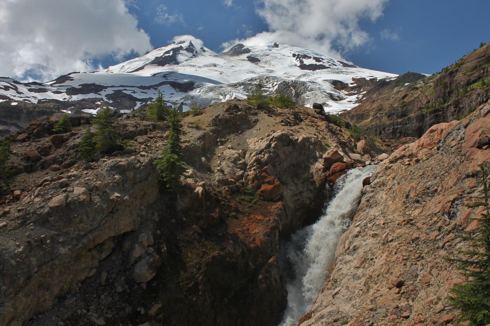

 |
|
| HOME SKAGIT COUNTY LINKS BEST IN THE NW WATERFALLS FOR KIDS FLICKR FACEBOOK STORE | |