![]()
BOULDER CREEK FALLS |
|
|
RATING - 64.0
VR - 6.0 (Med) HR - 7 SR - 11/20 TYPE OF APPROACH - Bushwhack DIFFICULTY - Very Difficult LOCATION - Baker Lake Area TYPE - Tiered HEIGHT - 303' WIDTH - 25' GPS - N48 44.411 W121 44.450 ELEVATION - 2450' |
While this is a very nice waterfall, most of the waterfall cannot be seen clearly thanks to the extremely tight canyon that it falls through. It's also extremely dangerous to climb down the cliff to view the lower tiers so I recommend leaving this one alone.
|
|
DIRECTIONS - Drive out Baker Lake Road and turn left onto FR 1130 just after
crossing Boulder Creek on a big, curving bridge. Take the left at the first
fork and follow that road to its end at the Boulder Ridge Trailhead. Hike
the trail for about 1.5 miles to a creek crossing (if you get to the meadows
you've gone a little too far). Leave the trail and head downhill through
the thick brush for about 1/2 a mile to the top of the falls. The slope
gets pretty steep towards the end but you'll eventually come out on top of
what looks like a dike made of bedrock. From here you'll have to climb down
the rocks to get views of the lower tiers. I didn't use a rope to make the
climb down, but it was really stupid of me not to. You should. NEARBY WATERFALLS - Boulder Glacier Falls, Crater Moraine Falls, Samantha Falls, Upper Boulder Creek Falls, Upper Boulder Glacier Falls, Upper Crater Moraine Falls |
|
|
ADDITIONAL PICTURES (CLICK TO ENLARGE) AND VIDEO
|
|
HOME WHATCOM COUNTY LINKS BEST IN THE NW WATERFALLS FOR KIDS FLICKR FACEBOOK STORE |
|
 Boulder
Creek Falls is one of the more interesting waterfalls on Mt. Baker.
The area immediately around the falls brings to mind an Eastern Washington
waterfall with orange rocks, dried moss, and plenty of evergreen trees.
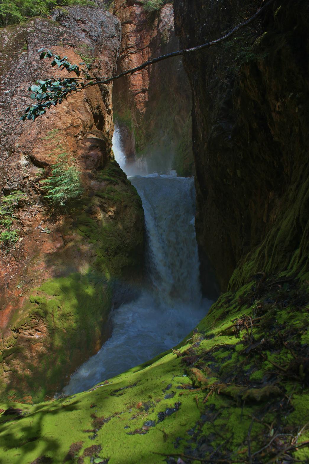
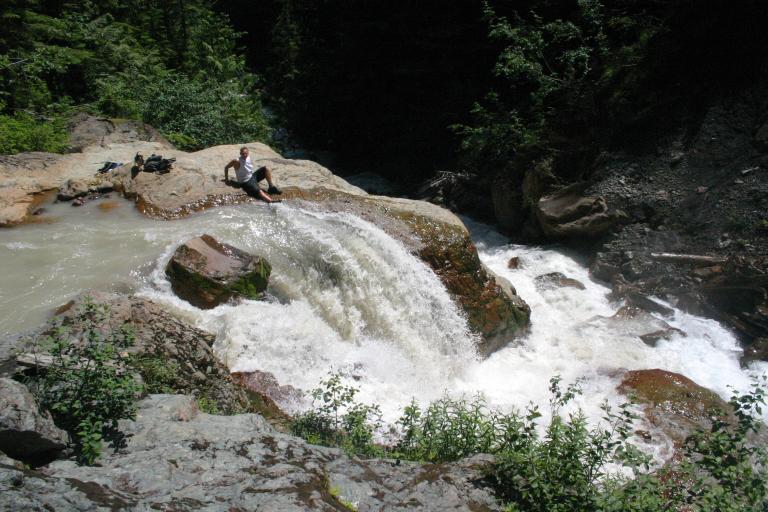
The waterfall drops a total of 303' over the course of several drops.
The waterfall begins with a 29' plunging drop that is pretty difficult to
see clearly. The creek then cascades and slides along the bedrock for
a couple hundred feet before reaching the main part of the waterfall.
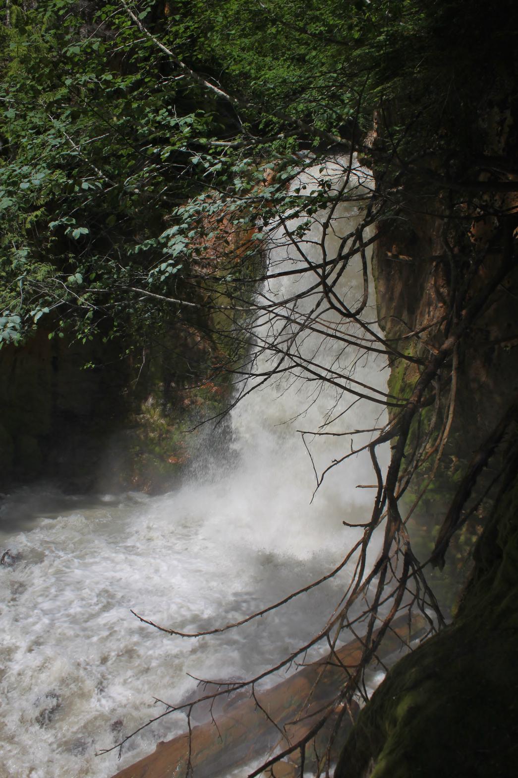
This main part begins with the very powerful, 55' tall plunging drop seen to
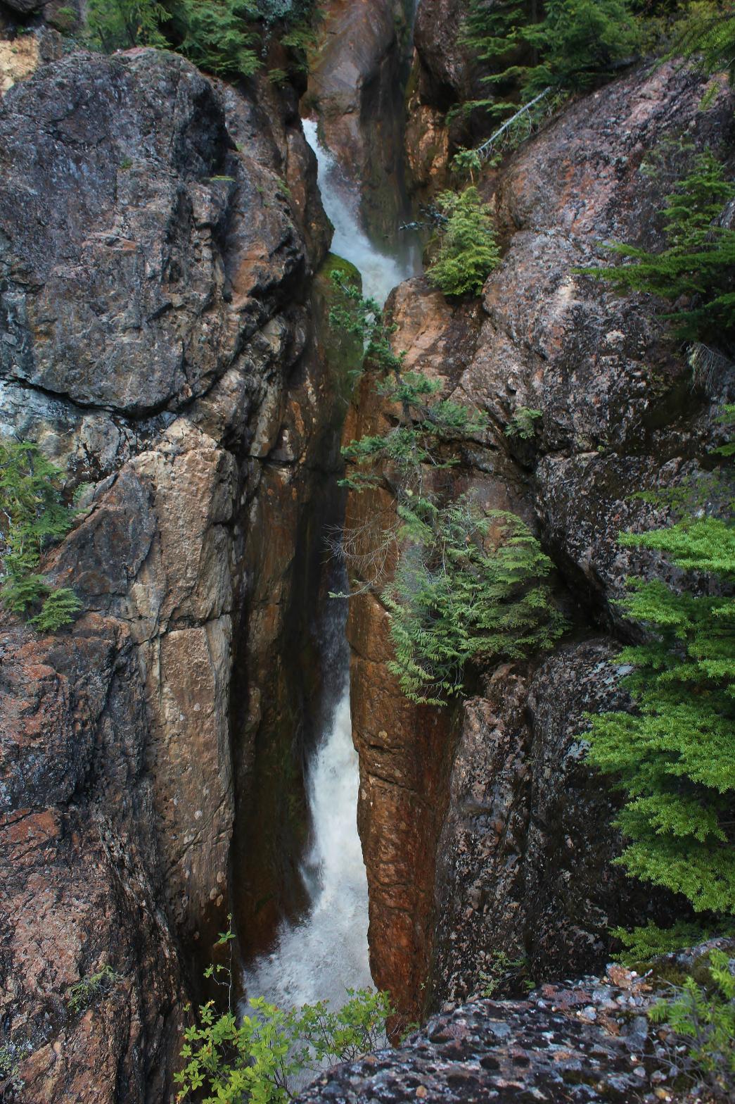
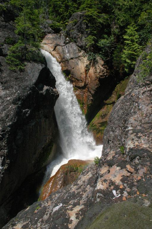
the left. The creek then enters a super tight slot canyon and drops
156' in several tiers that are very difficult to see thanks to the narrow
confines of the canyon. The waterfall continues with a 47' drop where
the creek splits around a boulder that has been wedged into the canyon.
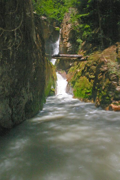
From there it runs through another narrow section, no more than 3' wide in
places, and finally rolls out of the canyon. Upon exiting, Boulder Creek has one last finale, shooting out
and dropping another 16' to join another fork of the creek. It's kind
of complicated to describe the waterfall. The pictures below are in
order from top to bottom (left to right) with the picture to the left going
in spot #2 if that helps.
Boulder
Creek Falls is one of the more interesting waterfalls on Mt. Baker.
The area immediately around the falls brings to mind an Eastern Washington
waterfall with orange rocks, dried moss, and plenty of evergreen trees.
The waterfall drops a total of 303' over the course of several drops.
The waterfall begins with a 29' plunging drop that is pretty difficult to
see clearly. The creek then cascades and slides along the bedrock for
a couple hundred feet before reaching the main part of the waterfall.
This main part begins with the very powerful, 55' tall plunging drop seen to
the left. The creek then enters a super tight slot canyon and drops
156' in several tiers that are very difficult to see thanks to the narrow
confines of the canyon. The waterfall continues with a 47' drop where
the creek splits around a boulder that has been wedged into the canyon.
From there it runs through another narrow section, no more than 3' wide in
places, and finally rolls out of the canyon. Upon exiting, Boulder Creek has one last finale, shooting out
and dropping another 16' to join another fork of the creek. It's kind
of complicated to describe the waterfall. The pictures below are in
order from top to bottom (left to right) with the picture to the left going
in spot #2 if that helps.