![]()
MALACHITE FALLS |
|
|
RATING - 82.0
VR - 8 (Big) HR - 9.0 SR - 10/20 TYPE OF APPROACH - Trail DIFFICULTY - Fairly Difficult LOCATION - Foss River Trail TYPE - Horsetail HEIGHT - 618' WIDTH - 65' GPS - N47 36.736 W121 19.699 ELEVATION - 2907' |
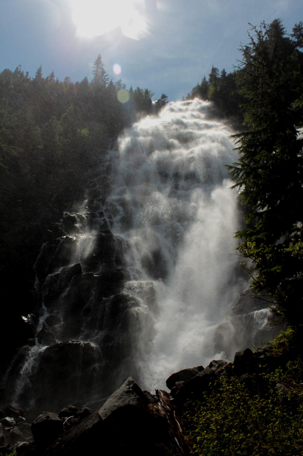
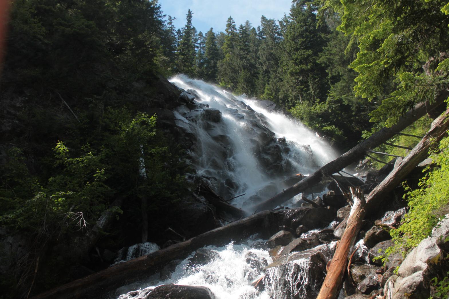
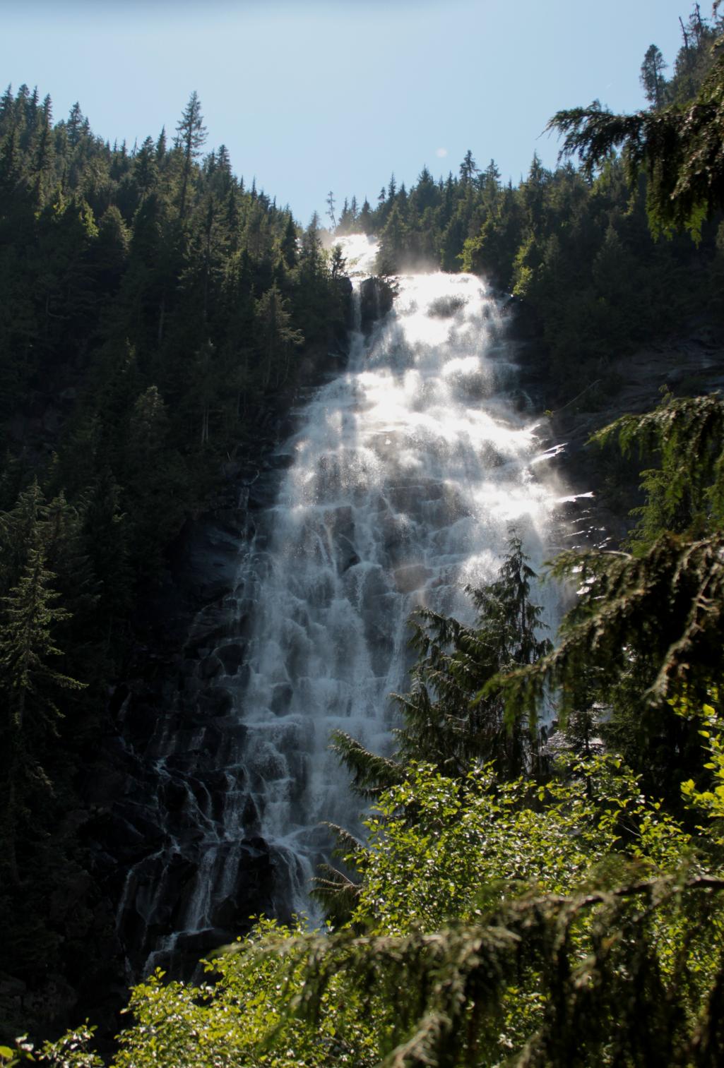
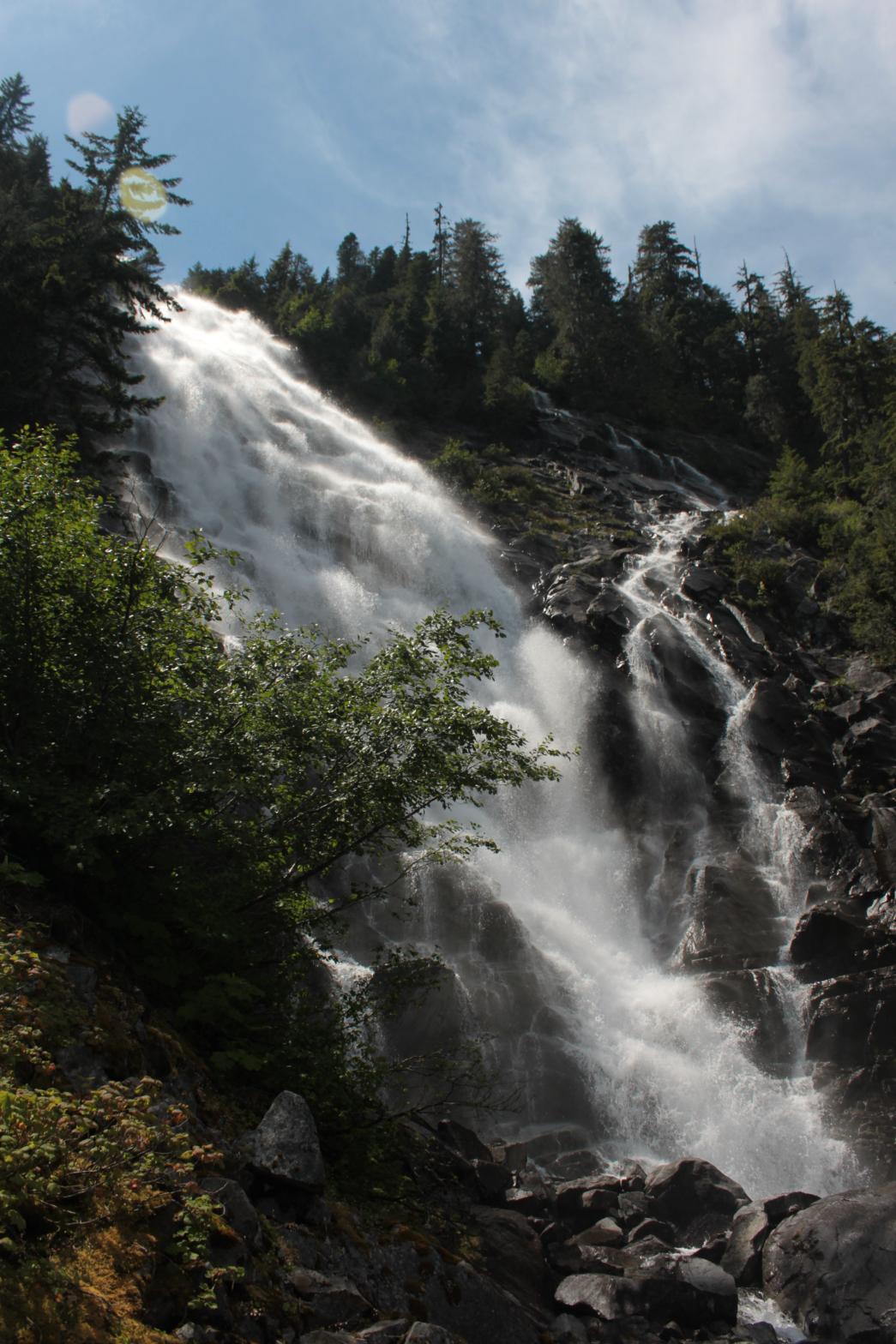 Malachite
Falls is one of the best waterfalls in the state. The massive
waterfall occurs where the outlets of Copper and Malachite Lakes drop over a
massive cliff located adjacent to the Copper Lake Trail. The segment
that comes from Copper Lake is what most people see. This giant
waterfall drops 618' in a series of horsetailing drops. The
bottom tier alone stand 329' in height and spreads out to 65' wide along the
way. The segment that comes from Malachite Lake cannot be seen at all
from the trail. From the base, only the bottom 80' tier can be seen.
This segment is most likely quite a bit taller than this, but either way
it's small beans compared to the beast next door. Malachite
Falls is one of the best waterfalls in the state. The massive
waterfall occurs where the outlets of Copper and Malachite Lakes drop over a
massive cliff located adjacent to the Copper Lake Trail. The segment
that comes from Copper Lake is what most people see. This giant
waterfall drops 618' in a series of horsetailing drops. The
bottom tier alone stand 329' in height and spreads out to 65' wide along the
way. The segment that comes from Malachite Lake cannot be seen at all
from the trail. From the base, only the bottom 80' tier can be seen.
This segment is most likely quite a bit taller than this, but either way
it's small beans compared to the beast next door.The falls can be seen fairly easily from the trail but a few trees will always block a view of the bottom. I was able to make it to the base of the falls with a lot of work (and a ton of scratches). From the bottom, you can't see the top so you might as well just enjoy the view from the trail. The first mile and a half of the trail is fairly easy, but once it starts switchbacking up towards the lake the going gets much rougher. |
|
DIRECTIONS - From Middle Copper Creek
Falls, continue along the travel, climbing higher and higher towards
Copper Lake. The first good view of the falls is about 1/2 a mile
after reaching Copper Creek. NEARBY WATERFALLS - Lower Copper Creek Falls, Lower Foss River Falls, Middle Copper Creek Falls, Shoestring Falls, Upper Foss River Falls |
|
ADDITIONAL
PICTURES (CLICK TO ENLARGE) AND VIDEO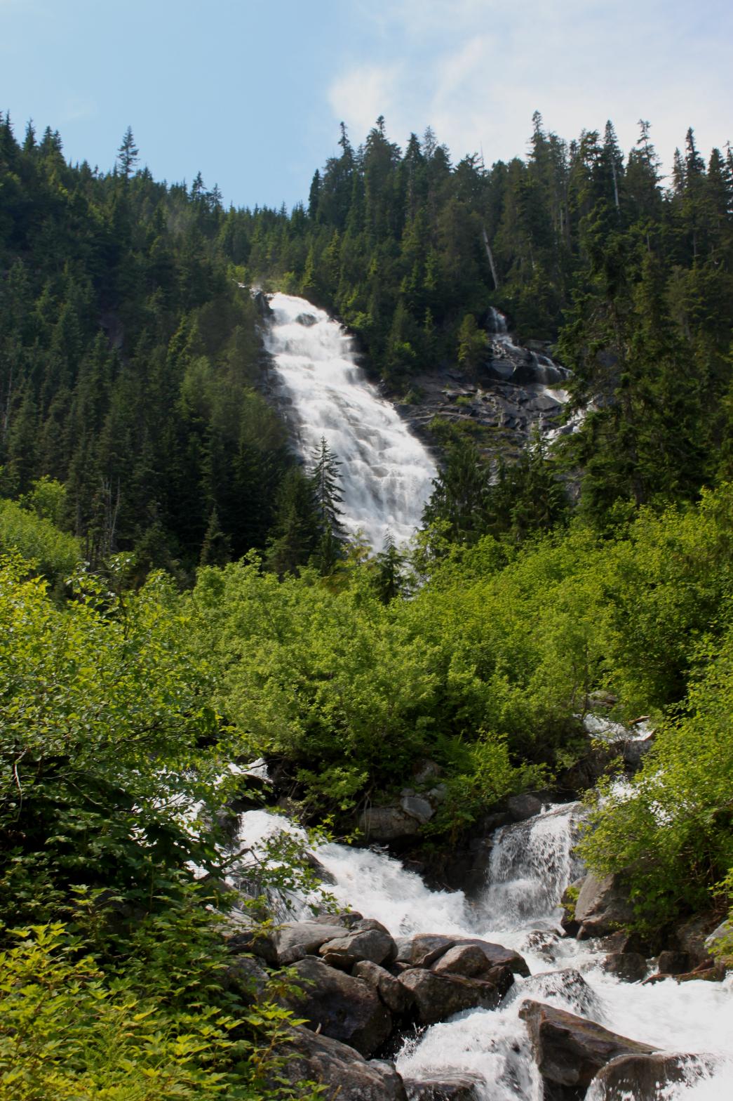
 |
|
HOME KING COUNTY LINKS BEST IN THE NW WATERFALLS FOR KIDS FLICKR FACEBOOK STORE |
|