![]()
SHOLES CREEK FALLS |
|
|
RATING -
54.0
VR - 6.0 (Med) HR - 6.0 SR - 18/20 TYPE OF APPROACH - Bushwhack DIFFICULTY - Extremely Difficult LOCATION - Wells Creek Road TYPE - Tiered HEIGHT - 165' WIDTH - 15' GPS - N48 51.273 W121 46.400 ELEVATION - 2921' |
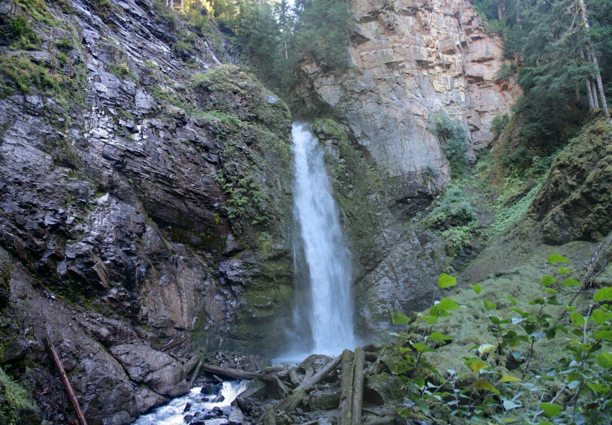
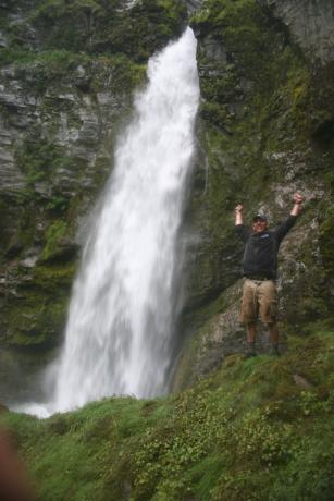
Technically this waterfall is tiered because there is a drop of around 60' immediately above the main drop but it can't be seen from the base of the falls. The amphitheater around the falls is really nice with a massive pillar of rock on the right side of the falls that looks like something you'd see in Southern Utah (other than the trees). I suspect there is at least one more large waterfall (and probably two) on Sholes Creek further upstream that I will attempt to reach this summer. |
| DIRECTIONS - Follow
the directions to Wells Creek Falls.
Continue past the falls to the bridge over Bar Creek. Park before the
bridge and head into the woods along the left side of Bar Creek. After a
short distance in the woods, you will drop down into Sholes Creek. Walking
up the creek a short ways will enable a view of the falls through the
trees. Getting better views can be accomplished one of two ways: wading up
the creek or following a very faint path along the steep canyon walls. This
path will get you pretty close, but the final climb down to a clear view is
very steep. If you take your time and move carefully you should be
alright but a mistake here would be bad. NEARBY WATERFALLS - Excelsior Falls, Landslide Falls, Lasiocarpa Falls, Lower Mazama Falls, Mazama Falls, Middle Sholes Creek Falls, Nooksack Falls, Wells Creek Falls |
|
VIDEO ADDITIONAL PICTURES (CLICK TO ENLARGE)
 |
|
HOME WHATCOM COUNTY LINKS BEST IN THE NW WATERFALLS FOR KIDS FLICKR FACEBOOK STORE |
|
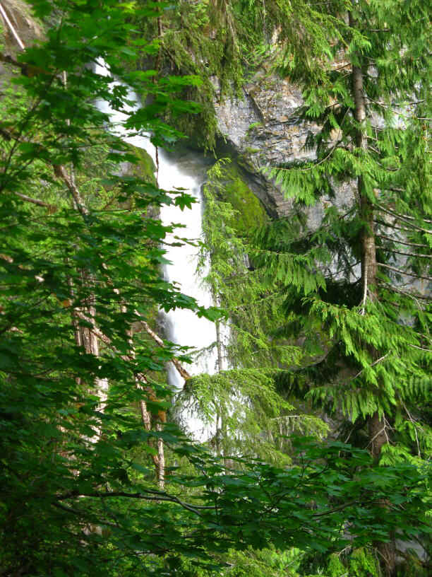
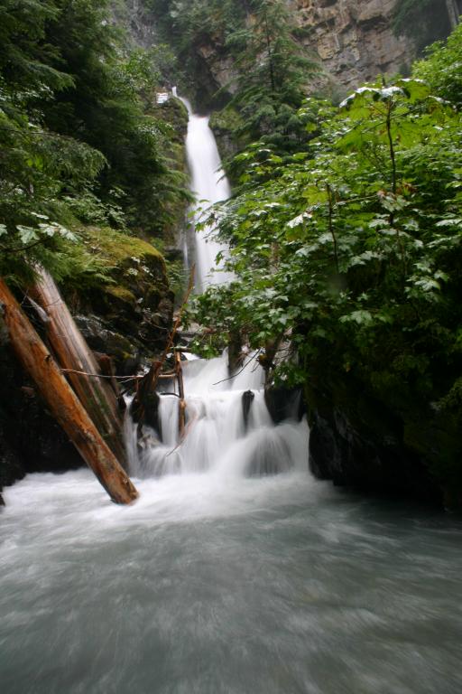
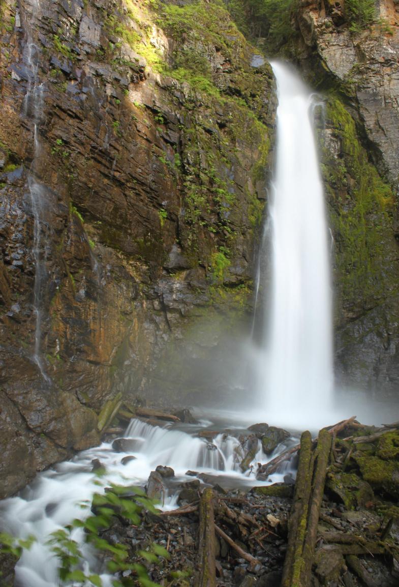 Sholes Creek Falls is a big impressive waterfall that is
EXTREMELY tough to get a clear view of. A view of the falls through
the trees can be had by just walking through the woods to the creek and then
looking upstream (2nd picture from the left below). Unfortunately
there's a little bend in the creek that must be navigated to get up close
and this is the tough part. From where you reach the creek, it is a 1/4 mile trip up the
creek to clear views of the falls. I recently made it into the falls by climbing sideways
along the steep walls of the canyon. I eventually got a better view of the falls but
it was pretty sketchy so I can't really recommend that route (or the creek route for that
matter).
Sholes Creek Falls is a big impressive waterfall that is
EXTREMELY tough to get a clear view of. A view of the falls through
the trees can be had by just walking through the woods to the creek and then
looking upstream (2nd picture from the left below). Unfortunately
there's a little bend in the creek that must be navigated to get up close
and this is the tough part. From where you reach the creek, it is a 1/4 mile trip up the
creek to clear views of the falls. I recently made it into the falls by climbing sideways
along the steep walls of the canyon. I eventually got a better view of the falls but
it was pretty sketchy so I can't really recommend that route (or the creek route for that
matter).