![]()
LOWER HUNTOON FALLS |
|
|
RATING - 26.0
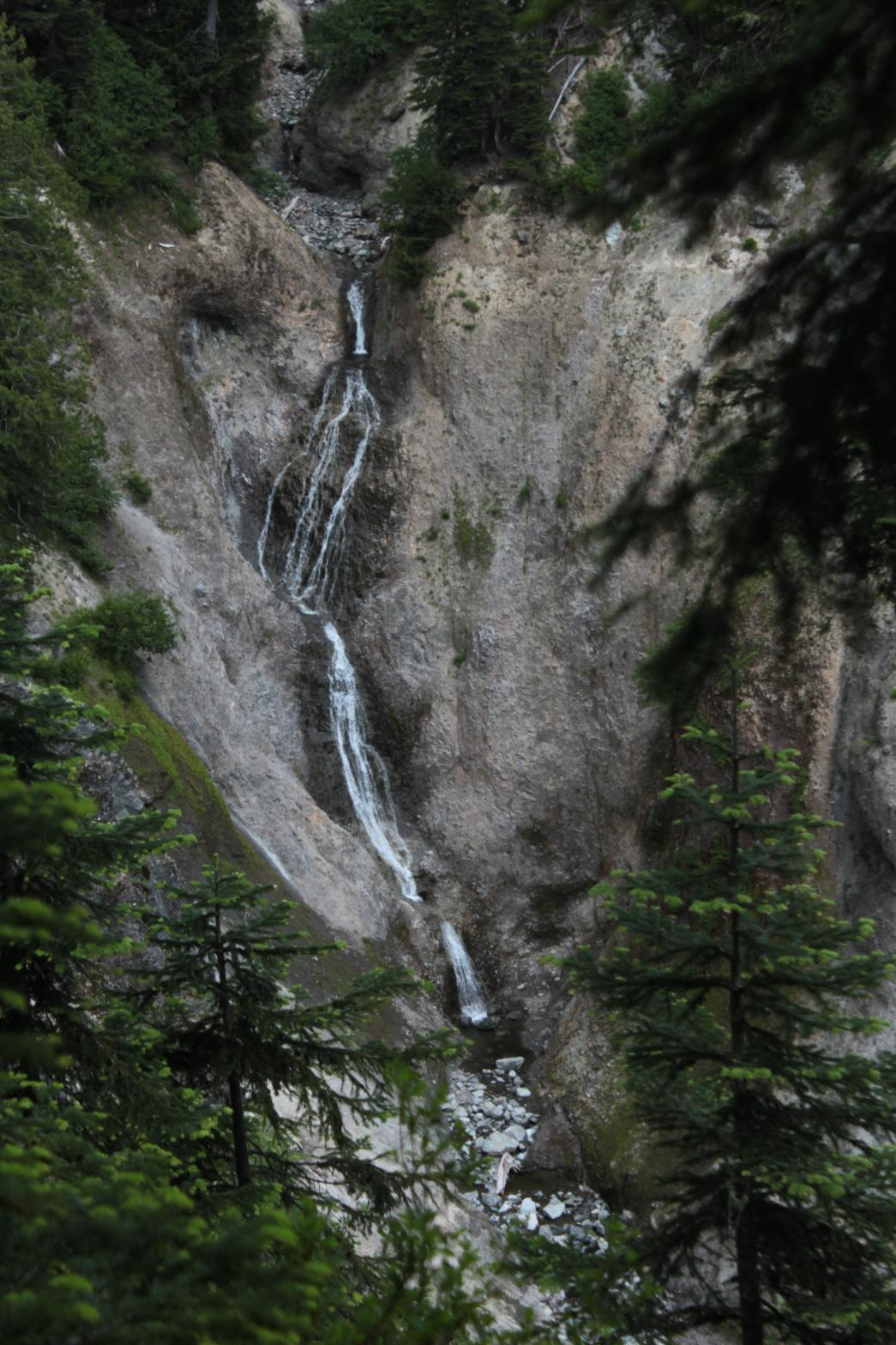
VR - 2 (Small) HR - 6.0 SR - 14/20 TYPE OF APPROACH - Trail + Bushwhack DIFFICULTY - Difficult LOCATION - Swift Creek Trail TYPE - Tiered HEIGHT - 130' * WIDTH - 10' GPS - N48 50' 1.20", W121 40' 12.23" ELEVATION - 3600' |
 The
Lake Anne Trail drops quickly from the parking lot and then enters a pretty
meadow with a nice creek. A short distance downstream from the trail
crossing the creek, it drops over two waterfalls. The upper falls is
the taller of the two but can't be clearly seen. The lower falls can
be seen clearly from the edge of the canyon. The falls drops in a
series of small drops into an otherworldly canyon that looks like it should
be on the moon. While the creek is very small and fairly seasonal, the
location and the amazing canyon makes this a really cool spot. The
Lake Anne Trail drops quickly from the parking lot and then enters a pretty
meadow with a nice creek. A short distance downstream from the trail
crossing the creek, it drops over two waterfalls. The upper falls is
the taller of the two but can't be clearly seen. The lower falls can
be seen clearly from the edge of the canyon. The falls drops in a
series of small drops into an otherworldly canyon that looks like it should
be on the moon. While the creek is very small and fairly seasonal, the
location and the amazing canyon makes this a really cool spot.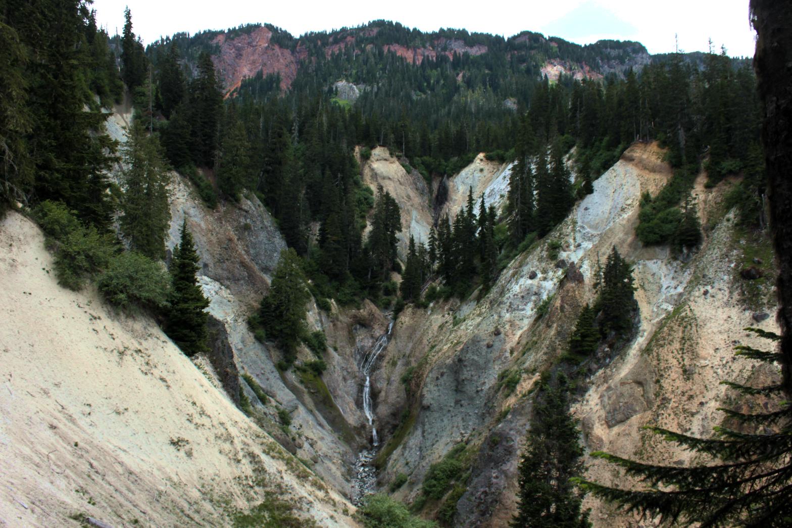 |
| DIRECTIONS -
From the Lake Ann Trailhead near the end of Mt. Baker Highway, hike along
the trail for about a mile and a half to where the trail crosses the creek
near the end of the meadows. Bushwhack down the west side of the
creek. It's brushy at first, but once the canyon opens up you should
find a very obvious mountain goat trail running along the rim of the canyon.
Follow it down until you see the falls. NEARBY WATERFALLS - Agathot Falls, Lower Agathot Falls, Middle Agathot Falls, Popahomy Falls, Ptarmigan Falls, Tatasum Falls, Upper Popahomy Falls |
|
HOME WHATCOM COUNTY LINKS BEST IN THE NW WATERFALLS FOR KIDS FLICKR FACEBOOK STORE |
|