![]()
UPPER POPAHOMY FALLS |
|
|
RATING - 8.0
VR - 2 (Small) HR - 3.0 SR - 2/20 TYPE OF APPROACH - Trail DIFFICULTY - Medium LOCATION - Swift Creek Trail TYPE - Horsetail HEIGHT - 50' WIDTH - 10' GPS - N48 50' 2.97", W121 39' 7.65" ELEVATION - 4250' |
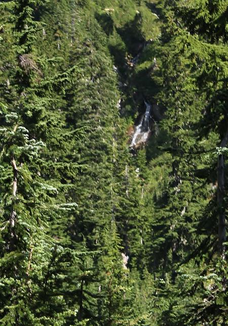 Popahomy
is a Nooksack word meaning "crossing place between two trails". The
creek where the falls occur crosses right at the intersection between the
Lake Anne and Swift Creek trails. While probably not as tall as it's
downstream brother, at least the upper falls on the creek can be seen with
some ease. It should be possible to scramble around and get up close
to this falls, but I was too tired on my trip into the area. I will
definitely get a closer view next time I visit this area and then I will
have better information and photos. This
waterfall is probably seasonal, running only when the snow is melting, but
it should run any time the Lake Anne Trail is hikable. Popahomy
is a Nooksack word meaning "crossing place between two trails". The
creek where the falls occur crosses right at the intersection between the
Lake Anne and Swift Creek trails. While probably not as tall as it's
downstream brother, at least the upper falls on the creek can be seen with
some ease. It should be possible to scramble around and get up close
to this falls, but I was too tired on my trip into the area. I will
definitely get a closer view next time I visit this area and then I will
have better information and photos. This
waterfall is probably seasonal, running only when the snow is melting, but
it should run any time the Lake Anne Trail is hikable. |
| DIRECTIONS -
Drive to the Lake Anne Trailhead near the end of Mt. Baker Highway.
Head down the trail for about 2 miles where the falls can be seen from the
trail. It should be possible to get closer by scrambling off trail
towards the falls. NEARBY WATERFALLS - Agathot Falls, Chokwil Falls, Coleman Falls, Hanging Rock Falls, Huntoon Falls, Lower Chowash Falls, Popahomy Falls, Ptarmigan Falls, Qanqan Falls, Tatasum Falls |
|
HOME WHATCOM COUNTY LINKS BEST IN THE NW WATERFALLS FOR KIDS FLICKR FACEBOOK STORE |
|