![]()
COLEMAN FALLS |
|
|
RATING -
62.0
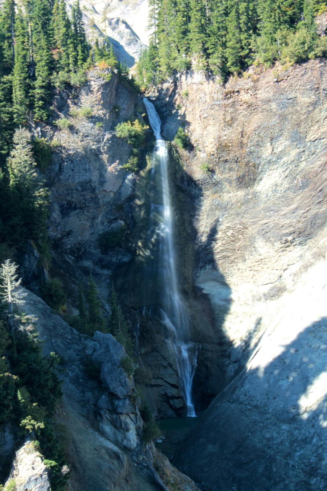
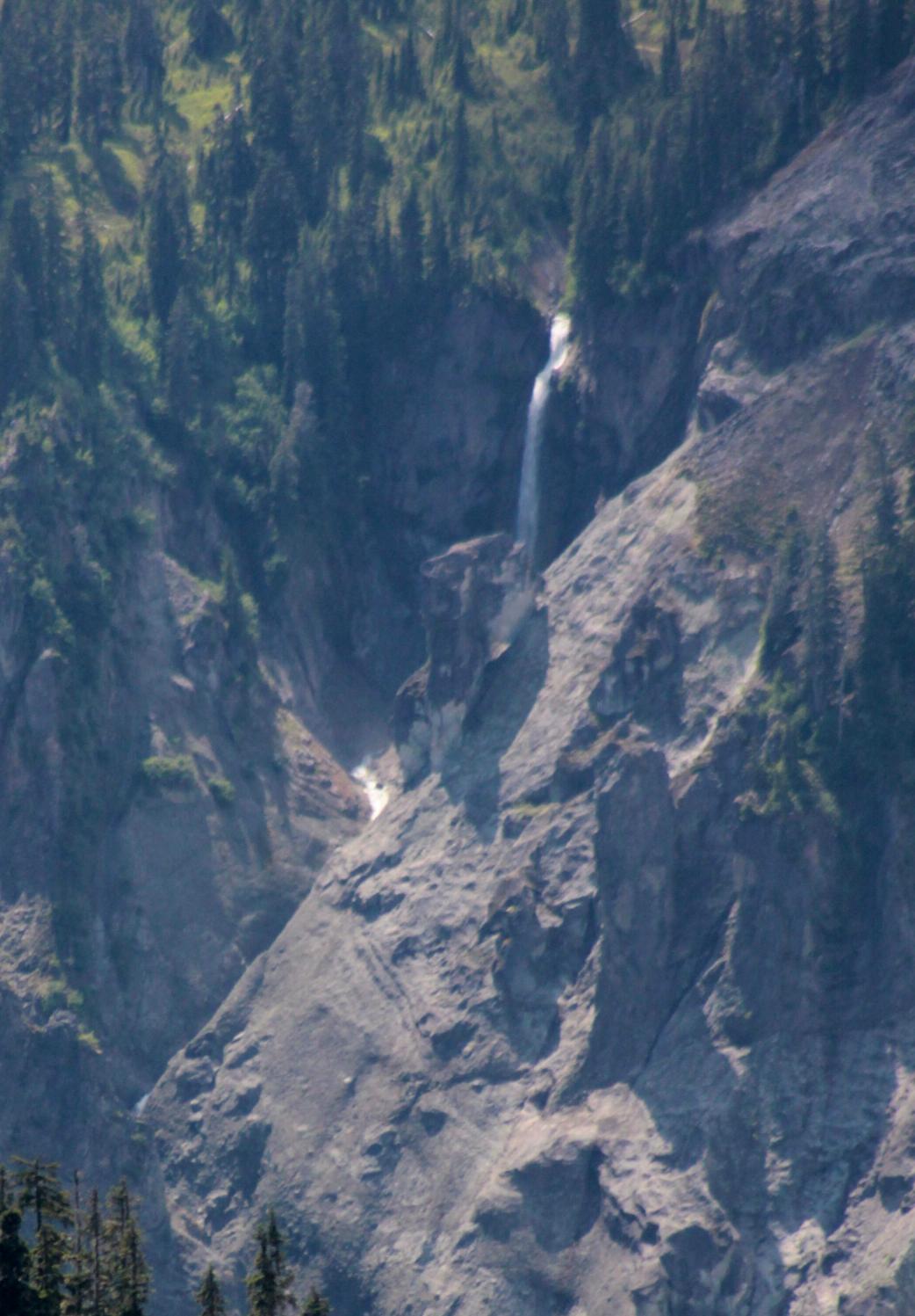
VR - 6 (Med) HR - 8 SR - 14/20 TYPE OF APPROACH - Trail DIFFICULTY - Very Difficult LOCATION - Swift Creek Trail TYPE - Tiered HEIGHT - 367' WIDTH - 10' GPS - N48 49' 0.92", W121 42' 43.79" ELEVATION - 3800' |
 The
Swift Creek area has the highest concentration of waterfalls in NW
Washington. Coleman Falls is one of the best of the bunch. The
creek encounters a large cliff and plunges 197' in a straight drop.
The creek then continues to drop down a series of sliding cascades bringing
the total height to 367'. In all likelihood, there is even more to the
waterfall below there, but it was impossible to see from atop the massive
cliff on my trip into the falls. To the right of the falls is a weird rock
that almost looks like a sea lion or something. It's quite bizarre. The
Swift Creek area has the highest concentration of waterfalls in NW
Washington. Coleman Falls is one of the best of the bunch. The
creek encounters a large cliff and plunges 197' in a straight drop.
The creek then continues to drop down a series of sliding cascades bringing
the total height to 367'. In all likelihood, there is even more to the
waterfall below there, but it was impossible to see from atop the massive
cliff on my trip into the falls. To the right of the falls is a weird rock
that almost looks like a sea lion or something. It's quite bizarre.
There are three ways to view the waterfall: distantly from the Lake Ann Trail, cross-valley from the Swift Creek Trail, or up close by hiking the Ptarmigan Ridge Trail and then taking a long, difficult off-trail trip to the top of the canyon. None of these three routes are particularly easy and the close-up trip is quite hazardous. This is one of those waterfalls that are absolutely amazing, but unfortunately so difficult to access that very few people will ever see them. I named Coleman Falls after Coleman Pinnacle, near where the creek begins. |
|
DIRECTIONS - Take the Swift Creek Trail. About a half a mile north of
Qanqan Falls, keep your eyes peeled across the
valley and you should see Coleman Falls plunging its way down the cliff.
You might have to scramble around a little to find a clear view. NEARBY WATERFALLS - Agathot Falls, Chokwil Falls, Hanging Rock Falls, Huntoon Falls, Lower Chowash Falls, Popahomy Falls, Ptarmigan Falls, Qanqan Falls, Tatasum Falls, Upper Coleman Falls, Upper Popahomy Falls |
|
ADDITIONAL
PICTURES (CLICK TO ENLARGE) AND VIDEO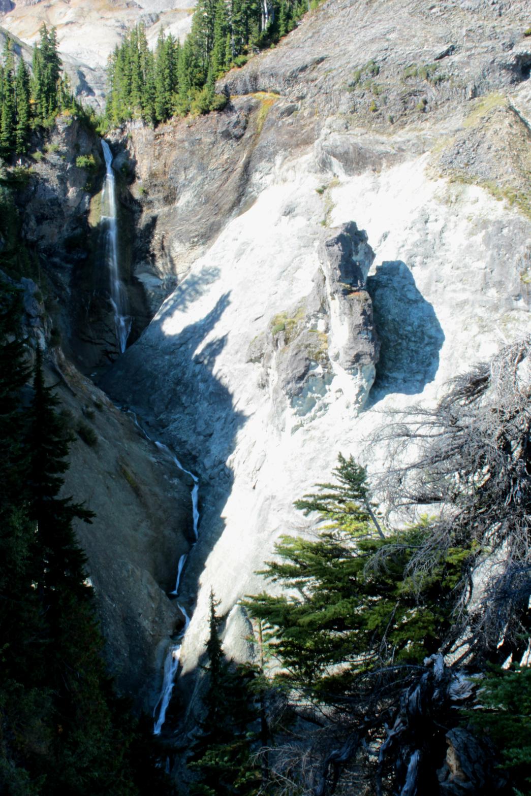

 |
|
HOME WHATCOM COUNTY LINKS BEST IN THE NW WATERFALLS FOR KIDS FLICKR FACEBOOK STORE |
|