![]()
LOWER CHOWASH FALLS |
|
|
RATING -
14.0
VR - 2 (Small) HR - 6.0 SR - 2/20 TYPE OF APPROACH - Trail DIFFICULTY - Very Difficult LOCATION - Swift Creek Trail TYPE - Tiered HEIGHT - 150' WIDTH - 30' GPS - N48 49' 28.13", W121 42' 38.3" ELEVATION - 3550' |
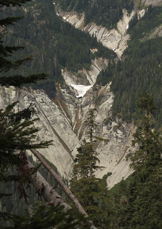 This
waterfall can be distantly seen from the Swift Creek Trail. The topo
maps show an upper falls as well but we couldn't see it from the trail.
I think it is at the elbow of this little canyon where it turns up to the
left in this picture. In addition, the topos have a waterfall dropping
in just below this waterfall. I believe this is the dark spot on the
right hand side of the canyon that crosses behind the tree. This creek
might have a little more water normally, but certainly not enough to warrant
a page on the site. Chowash is a Nooksack word meaning "wife". This
waterfall can be distantly seen from the Swift Creek Trail. The topo
maps show an upper falls as well but we couldn't see it from the trail.
I think it is at the elbow of this little canyon where it turns up to the
left in this picture. In addition, the topos have a waterfall dropping
in just below this waterfall. I believe this is the dark spot on the
right hand side of the canyon that crosses behind the tree. This creek
might have a little more water normally, but certainly not enough to warrant
a page on the site. Chowash is a Nooksack word meaning "wife". |
|
DIRECTIONS - Follow the directions to
Qanqan Falls. Lower Chowash Falls can be seen
across the valley from the trail at this point. NEARBY WATERFALLS - Agathot Falls, Chokwil Falls, Coleman Falls, Hanging Rock Falls, Huntoon Falls, Popahomy Falls, Ptarmigan Falls, Qanqan Falls, Tatasum Falls, Upper Popahomy Falls |
|
HOME WHATCOM COUNTY LINKS BEST IN THE NW WATERFALLS FOR KIDS FLICKR FACEBOOK STORE |
|