![]()
TATASUM FALLS |
|
|
RATING -
24.2
VR - 1.8 (Small) HR - 9.0 SR - 8/20 TYPE OF APPROACH - Trail DIFFICULTY - Easy LOCATION - Swift Creek Trail TYPE - Tiered HEIGHT - 662' * WIDTH - 40' GPS - N48 49' 26.71", W121 40' 27.91" ELEVATION - 3600' |
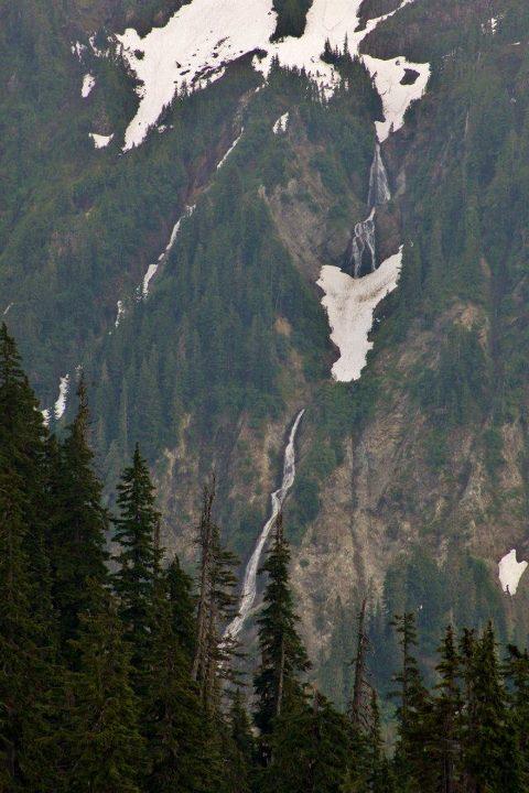 Tatasum
is a Nooksack word meaning "above us". From the Swift Creek Trail,
this tall waterfall is certainly above you. From the trail, 480' worth
of waterfall can be seen. I measured the top of the cliff at 662'. The view from Artists
Point is further away, but the upper section of the falls can also be seen.
This waterfall isn't worth the hike by itself, but if for some reason you're
hiking the Swift Creek Trail, you'll pass right by it anyway. Tatasum
is a Nooksack word meaning "above us". From the Swift Creek Trail,
this tall waterfall is certainly above you. From the trail, 480' worth
of waterfall can be seen. I measured the top of the cliff at 662'. The view from Artists
Point is further away, but the upper section of the falls can also be seen.
This waterfall isn't worth the hike by itself, but if for some reason you're
hiking the Swift Creek Trail, you'll pass right by it anyway. |
|
DIRECTIONS - Drive to Artists Point at the end of the Mt. Baker Highway.
Follow the trail up towards Huntoon Point. The falls can be seen to
the southwest. Alternately, the creek is crossed just downstream from
the falls about 4.5 mile along the Swift Creek Trail. NEARBY WATERFALLS - Agathot Falls, Chokwil Falls, Coleman Falls, Hanging Rock Falls, Huntoon Falls, Lower Chowash Falls, Lower Tatasum Falls, Middle Agathot Falls, Popahomy Falls, Ptarmigan Falls, Qanqan Falls, Upper Popahomy Falls |
|
ADDITIONAL
PICTURES (CLICK TO ENLARGE)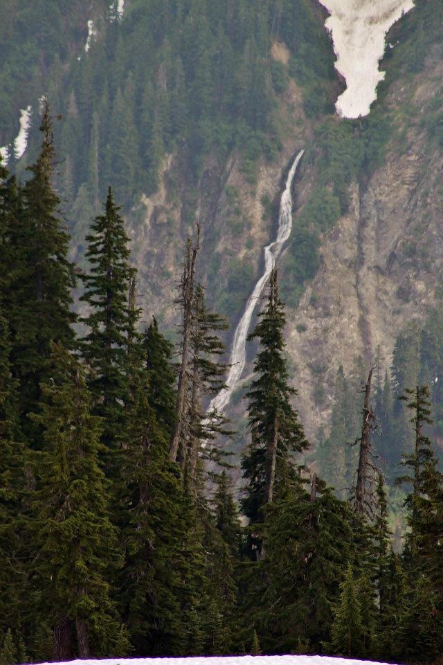
 |
|
HOME WHATCOM COUNTY LINKS BEST IN THE NW WATERFALLS FOR KIDS FLICKR FACEBOOK STORE |
|