![]()
MIDDLE AGATHOT FALLS |
|
|
RATING - 24.0
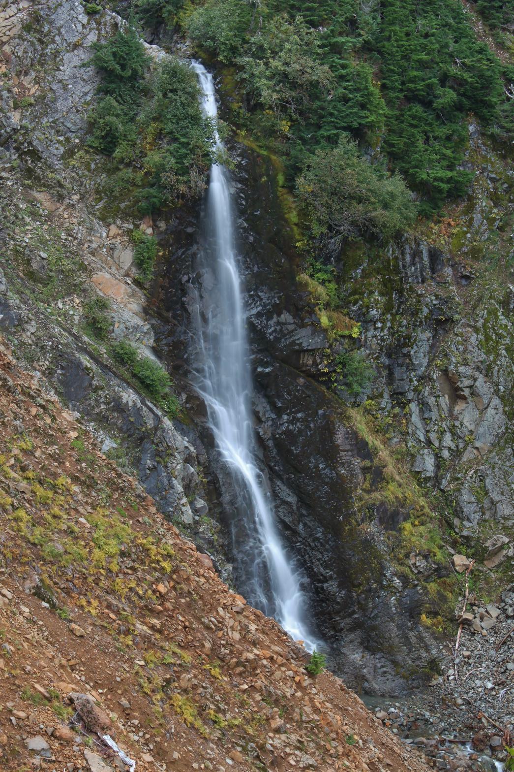
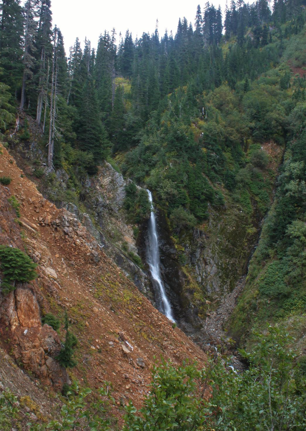
VR - 2 (Small) HR - 5.0 SR - 14/20 TYPE OF APPROACH - Trail + Bushwhack DIFFICULTY - Fairly Difficult LOCATION - Swift Creek Trail TYPE - Plunge HEIGHT - 116' WIDTH - 10' GPS - N48 49' 39.53", W121 40' 09.29" ELEVATION - 3400' |
 The
unofficially named Agathot Creek appears to contain three waterfalls.
Agathot Falls can be seen fairly easily from just off the Swift Creek Trail.
The middle falls is a little more difficult to view, but if you make it to
the view of Agathot Falls, this one isn't horrifically difficult from there.
Middle Agathot Falls is a plunging cataract that drops 116'. The
canyon around the falls is a collapsed wall of loose rock that contains some
amazingly bright, orange rocks. I have no idea what causes the orange
rock, but I haven't seen it anywhere else around the Swift Creek drainage so
for some reason it seems to be unique to this particular creek. For
those who want to see the falls without bushwhacking, a cross valley view of
this and nearby Popahomy falls can be had about 2.5 miles along the
Ptarmigan Ridge Trail. The
unofficially named Agathot Creek appears to contain three waterfalls.
Agathot Falls can be seen fairly easily from just off the Swift Creek Trail.
The middle falls is a little more difficult to view, but if you make it to
the view of Agathot Falls, this one isn't horrifically difficult from there.
Middle Agathot Falls is a plunging cataract that drops 116'. The
canyon around the falls is a collapsed wall of loose rock that contains some
amazingly bright, orange rocks. I have no idea what causes the orange
rock, but I haven't seen it anywhere else around the Swift Creek drainage so
for some reason it seems to be unique to this particular creek. For
those who want to see the falls without bushwhacking, a cross valley view of
this and nearby Popahomy falls can be had about 2.5 miles along the
Ptarmigan Ridge Trail. |
| DIRECTIONS -
Follow the directions to Agathot Falls.
Continue downstream along the edge of the canyon for another few hundred
feet. The going gets a little steeper but you will eventually see the
falls. The best view is from a small promentory that juts out
downstream from the falls. Be careful you don't fall. NEARBY WATERFALLS - Agathot Falls, Huntoon Falls, Lower Tatasum Falls, Popahomy Falls, Ptarmigan Falls, Tatasum Falls, Upper Popahomy Falls |
|
ADDITIONAL
PICTURES (CLICK TO ENLARGE) AND VIDEO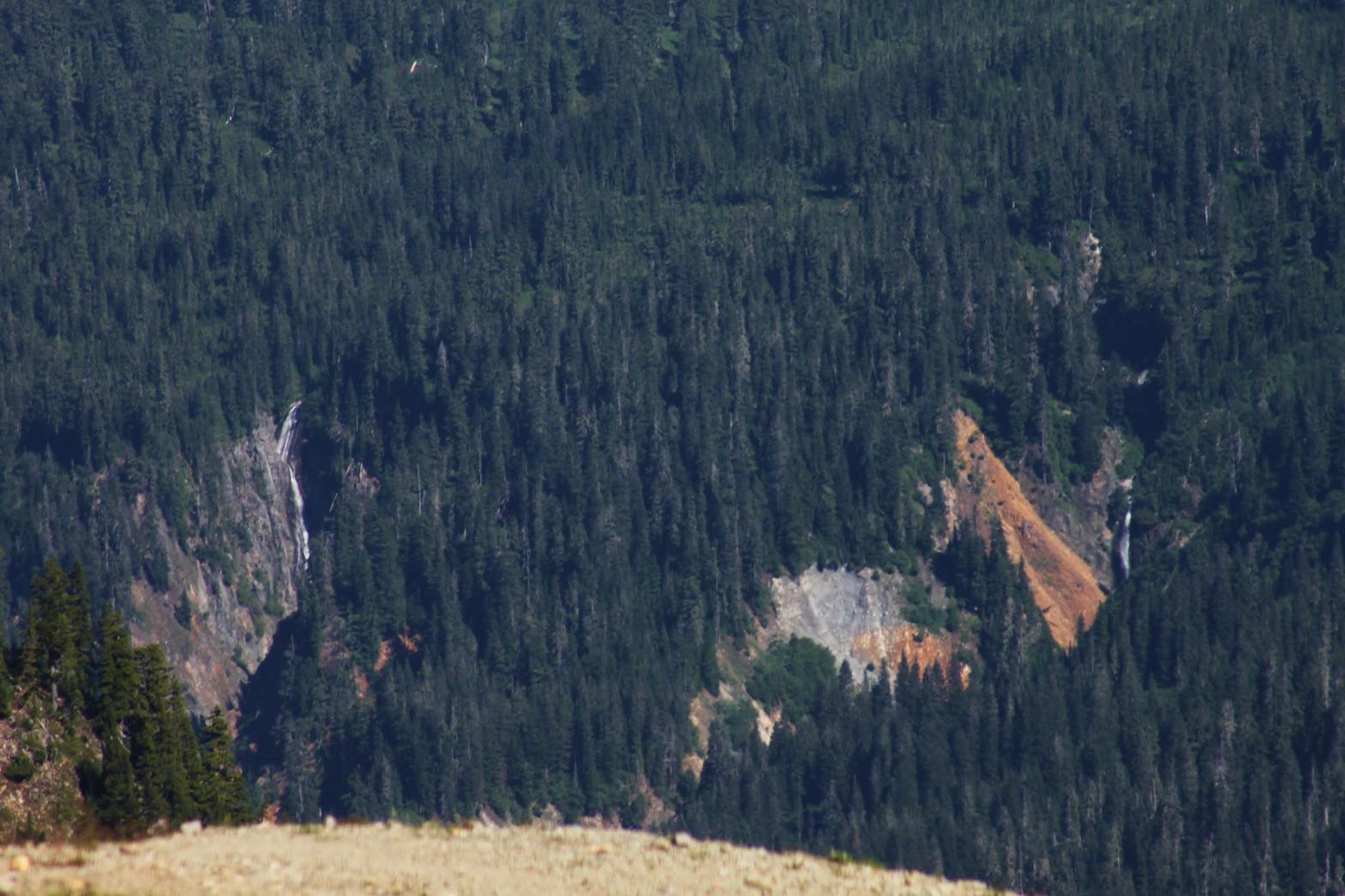
 |
|
HOME WHATCOM COUNTY LINKS BEST IN THE NW WATERFALLS FOR KIDS FLICKR FACEBOOK STORE |
|